This hike leads to the summit of Mt. Minsi on the white-blazed Appalachian Trail with an elevation gain of 1,060 feet in about two miles, passing a number of viewpoints along the way. After reaching the summit, with a panoramic south-facing view, you return to your car on the Mt. Minsi Fire Road. A special feature of the hike is that, for much of the way, the trail passes through dense...
Hike Description:
This hike leads to the summit of Mt. Minsi on the white-blazed Appalachian Trail with an elevation gain of 1,060 feet in about two miles, passing a number of viewpoints along the way. After reaching the summit, with a panoramic south-facing view, you return to your car on the Mt. Minsi Fire Road. A special feature of the hike is that, for much of the way, the trail passes through dense thickets of rhododendron.
From the kiosk in the Lake Lenape parking lot, follow the white-blazed Appalachian Trail (A.T.), which heads south along an old paved road. After passing the lake on the right, the paving ends, and the A.T. begins to head uphill on a gravel road. In a third of a mile, the A.T. bears left at a fork, narrows to a footpath, and soon descends a little.
After passing some interesting flat rocks on the right, the trail crosses a stream on stepping stones. It continues through dense rhododendron thickets, crosses another stream on rocks, and comes out at a limited viewpoint overlooking the Delaware River and the Delaware Water Gap, with Mt. Tammany visible to the right. Unfortunately, you can hear and see the traffic on I-80 below.
Soon, the trail bears right, away from the river and the highway. After crossing another small stream on rocks, you’ll begin to hear the sound of rushing water on the left. The trail curves to the left, passes through dense rhododendron thickets, and crosses Eureka Creek (marked with a sign on a tree) on rocks. There is an attractive cascade on the right at the stream crossing, and this is a great place to take a break.
A short distance beyond, the A.T. bears right and climbs rock steps. Here, you should continue ahead on the footpath you’ve been following. Just ahead, you’ll reach a spectacular viewpoint over the Delaware River and Mt. Tammany. After taking in the view, retrace your steps along the footpath until you reach the rock steps (now on your left), then turn left and climb the steps.
The A.T. now begins a steady climb on switchbacks. After traversing an open area, the climb steepens as the trail ascends rock steps through dense rhododendron thickets. Finally, about 1.8 miles from start, the A.T. reaches a junction with the Mt. Minsi Fire Road. This will be your return route, but for now, continue along the A.T., which briefly joins the fire road, then turns right into the woods. A short distance beyond, the A.T. turns right onto the fire road and follows it through a “tunnel” of rhododendron, with the thick rhododendron branches forming a canopy over the trail.
After climbing over rocks, the trail reaches Minsi Lookout, from which Mt. Tammany (but not I-80 or the Delaware River) can be seen. The A.T. now descends a little, then climbs on a rocky footpath to reach the summit of Mt. Minsi (1,461 feet), marked by the concrete footings and stone steps of a former fire tower that once stood here. Continue ahead, passing on the left a fenced-in area for a communications tower and a small building. Just ahead, you’ll notice an unmarked footpath heading to the left. Turn left and follow this footpath to a panoramic south-facing viewpoint. You can’t see Mt. Tammany from here, but you can see down the Delaware River for quite a distance.
Three bridges over the river are visible from here. The most northerly bridge was built in 1910 as part of the Lackawanna Cut-Off – a stupendous engineering feat that cut 11 miles and many degrees of curvature from the Main Line of the Delaware, Lackawanna and Western Railroad. Unfortunately, the Cut-Off (including the Delaware River Viaduct) was abandoned in 1979. The next bridge to the south is a pedestrian bridge, built on the original stone abutments of a covered bridge that spanned the river from 1869 until it was washed away by a flood in 1955. The third bridge is the highway bridge between Columbia, New Jersey and Portland, Pennsylvania, built in 1953. Beyond the three bridges you can see, on the west side of the river, the former Portland Generating Station (which closed in 2015).
You’ll want to spend some time here, resting from the climb and taking in the view. When you’re ready to continue, turn right and retrace your steps along the A.T., but when the A.T. diverges from the Mt. Minsi Fire Road, continue ahead on the fire road. The fire road descends the mountain through thickets of rhododendron and mountain laurel, for the most part on more gentle grades than the A.T., which you followed going up the mountain. There are no views along the fire road, but it provides an alternate route for the descent. Towards the base of the descent, the A.T. merges with the fire road, and you should follow the A.T. back to the start of the hike.
Publication: Submitted by Daniel Chazin on 04/08/2024

This hike leads to the summit of Mt. Minsi on the white-blazed Appalachian Trail with an elevation gain of 1,060 feet in about two miles, passing a number of viewpoints along the way.
40.980056, -75.141986
Monroe Co., PA
5 mi
3.5 hrs

Hike Checklist:
Whether you are going for a day hike or backpacking overnight, it is good practice to carry what we call The Hiking Essentials. These essentials will help you enjoy your outing more and will provide basic safety gear if needed. There may also be more essentials, depending on the season and your needs.
The Essentials
Hiking Shoes or Boots
Water - Two quarts per person is recommended in every season. Keep in mind that fluid loss is heightened in winter as well as summer. Don't put yourself in the position of having to end your hike early because you have run out of water.
Map - Know where you are and where you are going. Many of our hiking areas feature interconnecting network of trails. Use a waterproof/tear-resistant Tyvek Trail Conference map if available or enclose your map in a Ziplock plastic bag. If you have a mobile device, download Avenza’s free PDF Maps app and grab some GPS-enhanced Trail Conference maps (a backup Tyvek or paper version of the map is good to have just in case your batteries die or you don't have service). Check out some map-reading basics here.
Food - Snacks/lunch will keep you going as you burn energy walking or climbing. Nuts, seeds, and chocolate are favorites on the trail.
Sunscreen and insect repellent
Rain Gear and Extra Clothing - Rain happens. So does cold. Be prepared for changing weather. Avoid cotton--it traps water against your skin and is slow to dry. If you are wearing wet cotton and must return to your starting point, you risk getting chills that may lead to a dangerous hypothermia. Choose synthetic shirts, sweaters and/or vests and dress in layers for easy on and off.
Compass - A simple compass is all you need to orient you and your map to magnetic north.
Light - A flashlight or small, lightweight headlamp will be welcome gear if you find yourself still on the trail when darkness falls. Check the batteries before you start out and have extras in your pack.
First Aid Kit - Keep it simple, compact, and weatherproof. Know how to use the basic components.
Firestarter and Matches - In an emergency, you may need to keep yourself or someone else warm until help arrives. A firestarter (this could be as simple as leftover birthday candles that are kept inside a waterproof container) and matches (again, make sure to keep them in a waterproof container) could save a life.
Knife or Multi-tool - You may need to cut a piece of moleskin to put over a blister, repair a piece of broken equipment, or solve some other unexpected problem.
Emergency Numbers - Know the emergency numbers for the area you're going to and realize that in many locations--especially mountainous ones, your phone will not get reception.
Common Sense - Pay attention to your environment, your energy, and the condition of your companions. Has the weather turned rainy? Is daylight fading? Did you drink all your water? Did your companion fail to bring rain gear? Are you getting tired? Keep in mind that until you turn around you are (typically) only half-way to completing your hike--you must still get back to where you started from! (Exceptions are loop hikes.)
Check the weather forecast before you head out. Know the rules and regulations of the area.
The Leave No Trace Seven Principles
Plan Ahead and Prepare
- Know the regulations and special concerns for the area you'll visit.
- Prepare for extreme weather, hazards, and emergencies.
- Schedule your trip to avoid times of high use.
- Visit in small groups when possible. Consider splitting larger groups into smaller groups.
- Repackage food to minimize waste.
- Use a map and compass to eliminate the use of marking paint, rock cairns or flagging.
Travel and Camp on Durable Surfaces
- Durable surfaces include established trails and campsites, rock, gravel, dry grasses or snow.
- Protect riparian areas by camping at least 200 feet from lakes and streams.
- Good campsites are found, not made. Altering a site is not necessary.
- In popular areas:
- Concentrate use on existing trails and campsites.
- Walk single file in the middle of the trail, even when wet or muddy.
- Keep campsites small. Focus activity in areas where vegetation is absent.
- In pristine areas:
- Disperse use to prevent the creation of campsites and trails.
- Avoid places where impacts are just beginning.
- Pack it in, pack it out. Inspect your campsite and rest areas for trash or spilled foods. Pack out all trash, leftover food and litter.
- Deposit solid human waste in catholes dug 6 to 8 inches deep, at least 200 feet from water, camp and trails. Cover and disguise the cathole when finished.
- Pack out toilet paper and hygiene products.
- To wash yourself or your dishes, carry water 200 feet away from streams or lakes and use small amounts of biodegradable soap. Scatter strained dishwater.
- Preserve the past: examine, but do not touch cultural or historic structures and artifacts.
- Leave rocks, plants and other natural objects as you find them.
- Avoid introducing or transporting non-native species.
- Do not build structures, furniture, or dig trenches.
- Campfires can cause lasting impacts to the backcountry. Use a lightweight stove for cooking and enjoy a candle lantern for light.
- Where fires are permitted, use established fire rings, fire pans, or mound fires.
- Keep fires small. Only use sticks from the ground that can be broken by hand.
- Burn all wood and coals to ash, put out campfires completely, then scatter cool ashes.
- Observe wildlife from a distance. Do not follow or approach them.
- Never feed animals. Feeding wildlife damages their health, alters natural behaviors, and exposes them to predators and other dangers.
- Protect wildlife and your food by storing rations and trash securely.
- Control pets at all times, or leave them at home.
- Avoid wildlife during sensitive times: mating, nesting, raising young, or winter.
Be Considerate of Other Visitors
- Respect other visitors and protect the quality of their experience.
- Be courteous. Yield to other users on the trail.
- Step to the downhill side of the trail when encountering pack stock.
- Take breaks and camp away from trails and other visitors.
- Let nature's sounds prevail. Avoid loud voices and noises.
The Trail Conference is a 2015 Leave No Trace partner.
(c) Leave No Trace Center for Outdoor Ethics: www.LNT.org.
Directions to Trailhead :
From New Jersey, cross the Delaware River on the I-80 toll bridge. Stay to the right at the tollbooth and immediately take Exit 310. Follow signs for Route 611 south down a circular ramp. At the end of the ramp, turn right on Broad Street At the next light turn left onto Route 611 south. Continue a few blocks to the Deerhead Inn on the right. Turn right immediately after the inn onto Mountain Road. Take the next left into the Lake Lenape parking area.
TRAIN TRANSPORT :
Not availableBUS TRANSPORT :
Not available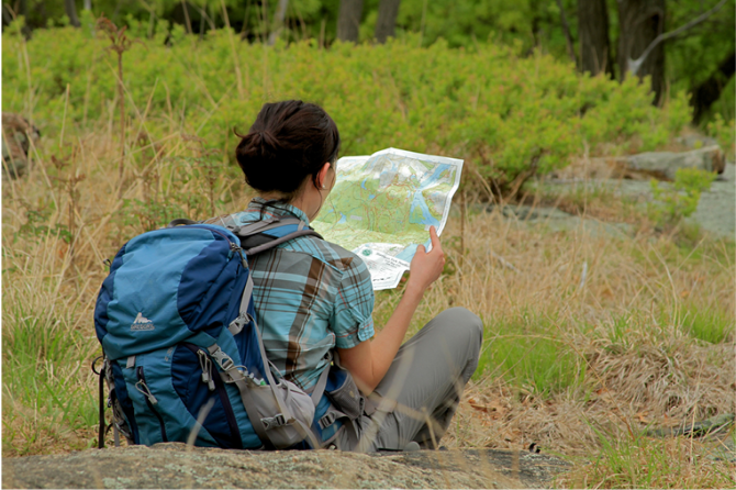
 Support the trails with a donation!
Trip Reports
rate experience
No reviews for this hike, click above rate experience link to review this hike
Log in or register to post comments