Crowdsourced Maps: How and When to Use Them
February 14, 2022
New York-New Jersey Trail Conference
Title
Crowdsourced Maps: How and When to Use Them
Body
The most important part of having a safe, enjoyable trail experience is being prepared. When you’re heading into the woods, that means having reliable navigation.
These days, we are blessed with an abundance of navigation resources: In addition to traditional paper maps, there are online hike descriptions, guide books, trailhead kiosks, downloadable park maps, interactive Avenza Maps app maps, and a multitude of outdoor recreation apps. With all these options, it can be hard to know which ones to use or trust.Some of these resources are curated, meaning that they are created by an authority or expert organization. Others are crowdsourced, meaning that anybody—regardless of their experience or expertise—can contribute information about an experience. Both types of resources are valuable, but it’s important to know when and how to use each one. Especially in the New York-New Jersey area, where trail networks are sometimes quite complex, curated information is an especially important resource. The table shown here can help you decide which resource to use and when to use it.
| CURATED INFORMATION | CROWDSOURCED INFORMATION | |
| Examples |
|
|
| Pros | Highlight official and maintained routes. Reliable and authoritative sources of objective information. | Allow for discussion, commentary, and an understanding of different experiences. Good sources of subjective information or “breaking news.” |
| Cons | May not always include subjective information about specific experiences. While regularly updated, they may not always have information on “breaking news” like trail hazards or recent relocations. | May have inaccurate, incomplete, or outdated information. User-submitted data can sometimes lead people to dangerous, non-existent, or illegal trail routes. May include confusing information, such as calling a loop hike made up of different trails and blaze colors a single “trail.” |
| Map Detail | Curated maps, such as the Trail Conference’s maps, typically show the entire network of trails within a park, complete with trail names, blaze colors, points of interest, and often distances. | In AllTrails, for example, the hike of interest is highlighted and the map may include other trails in a park; however, they are not typically labeled with trail names, blaze colors, or distances. |
To elaborate on the discussion surrounding crowdsourced trail information, we’re sharing the advice of Scott Fitterman. Scott is an experienced outdoorsman and a New Jersey Search and Rescue (SAR) team member, which has given him both personal and professional experience with different navigation resources. Below Scott talks about his personal experiences with the relative benefits and challenges of crowdsourced trail information.
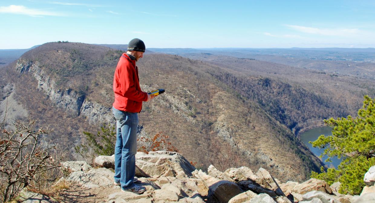
Since I wear a uniform, I’m often approached by hikers asking me for directions during our search and rescue drills. The first thing I always ask is what they’re using to navigate. More often than not they are solely relying on a crowdsourced hiking app on their phone such as AllTrails or Hiking Project.
Don’t get me wrong, I think crowdsourced hiking apps are an excellent resource. I use them all the time as a launchpad for route planning. I can search for the highest-rated hikes in an area that I’ve never been to, read trail reviews, find routes that are a certain length or have a certain elevation change, read about common errors people make on the trail so I can avoid them, and take note of all the cool viewpoints and points of interest.
However, as beneficial as crowdsourced hiking apps are, people seem unaware of the potential for getting lost or injured when using them as their only means of navigating. Crowdsourced hiking data is just that—unvetted tracks from anonymous hikers. [See sidebar below for more information.]
What people call a “trail” might be a combination of established blazed trails and unmarked trails or herd paths. Those unmarked trails that were easy to follow during the summer might be impossible to follow after the leaves fall in autumn. Tracks recorded on phones and watches can also be wildly inaccurate depending on signal strength, weather, where the device was kept while hiking, and app settings. Higher skill-level hikers might traverse dangerously steep terrain, putting you at risk for injury. Another hiker’s easy hike might be much more difficult to you. Hikers may even unwittingly cut across private property, putting you at risk as well. Luckily, there are ways to mitigate these risks to avoid a call to SAR for a rescue.
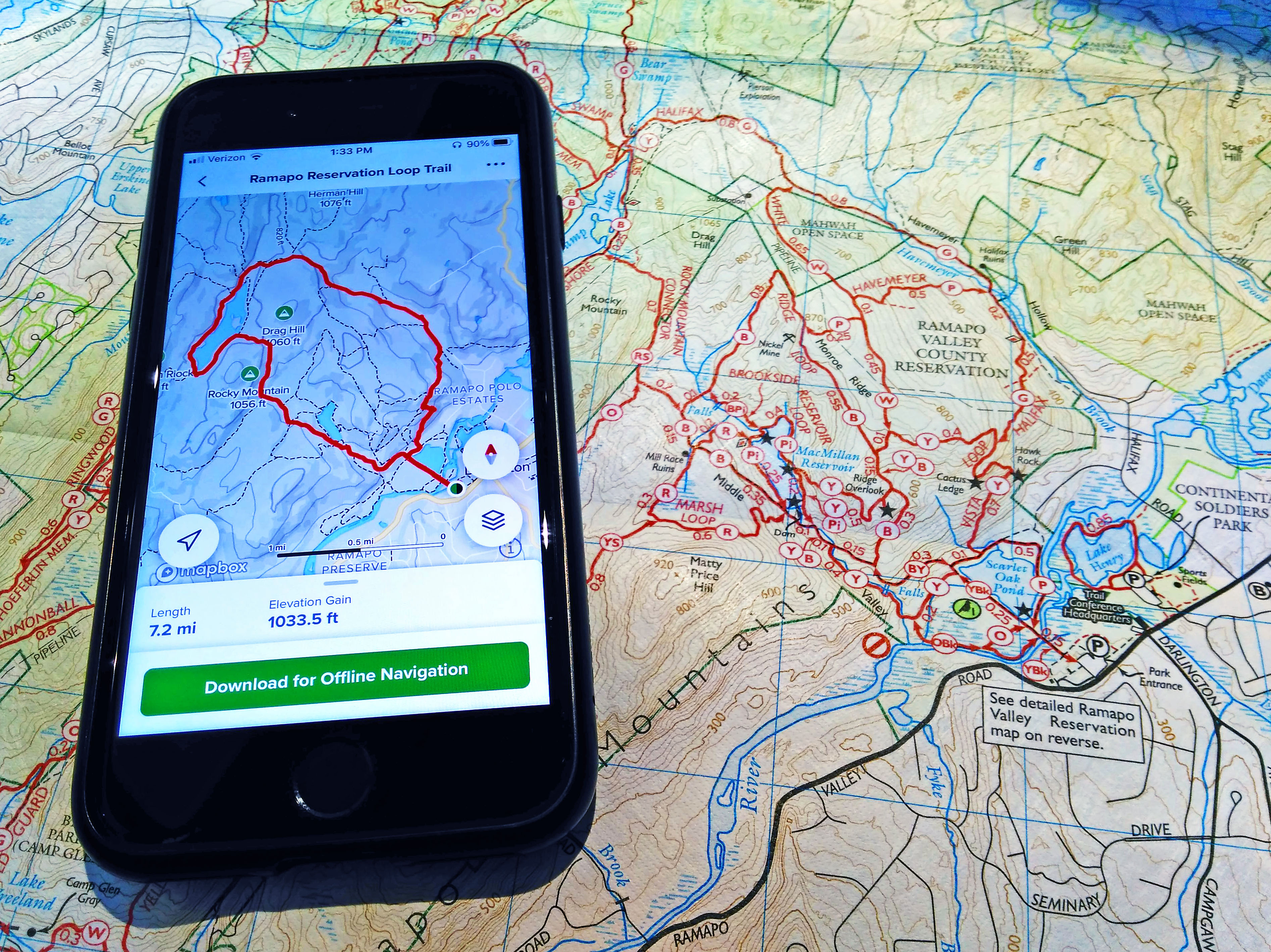
Even if you use a crowdsourced hiking app, we advise also using at least one navigation app with maps created by GIS professionals whose primary concern is accuracy. Apps like Avenza, which give you access to both free and paid accurate maps with blazed trails, such as those from the Trail Conference, are a nobrainer. Apps like Gaia can bring all the functionality of a dedicated GPS device right to your phone. Keep in mind that if you look at your screen often during your hike it could kill your battery. Charge your phone before you hike and always carry a charged portable battery charger as well. [Editor’s note: Some apps, such as Avenza and AllTrails, do not require cell service for GPS navigation. Check the app to see if you can use it in Airplane Mode to further save battery life.]
Learn how to use a hardcopy map and compass to navigate and carry them as a backup. It is a tried and true method of navigating that you can count on when you lose your phone or GPS device or your batteries die. There are many books and online videos to learn on your own, or you can take an in-person class.
Hike established blazed loop trails with the confidence that the trail is well-marked and will both start and end at the same location. This will help you avoid getting stranded in the dark by underestimating when to turn back and then having to navigate turns at trail intersections. Your worst case is to slowly continue on the same trail until you arrive back at the start.
Crowdsourced hiking apps can help make the most of the time you spend enjoying the outdoors hiking. They are an excellent tool but should always be used in conjunction with professionally accurate maps and trail data to reduce the chances of getting lost or hurt so you can hike another day.
A Further Note About AllTrails
When researching this article, volunteer Phil Heidelberger reached out to AllTrails for clarification on two topics that have led to confusion for hikers: inaccuracies in trail data, and the app’s offline capabilities.
Inaccurate Information
When asked about incorrect trail information appearing on AllTrails, a customer service representative for AllTrails said that all “trails” that you see in AllTrails are considered “verified routes” that are hand-curated. These appear as the thick red lines on trail pages, which sometimes contributes to the confusion—the route may be mistaken for one trail when in reality it is several individually named and blazed trails. The representative stated that the company’s goal “is that every trail on AllTrails has an accurate, hand-curated verified route.” When asked for clarification regarding their verification process, an AllTrails representative stated that their “team uses official maps, movement data, reviews, trail resources on the internet, other mapping apps to compare, and a few other methods to verify trails.” Inaccurate information can be reported to AllTrails via the Suggest Edit button found on trail pages.
Meanwhile, “the black and blue dashed lines that you see on the AllTrails map type come directly from OpenStreetMap—a collaborative mapping project which offers a free editable map of the world,” the representative said. If you see inaccuracies on these trails, AllTrails recommends using OSM’s online platform to edit these trail segments so that the changes will be reflected in their database as well.
For these reasons, we recommend that you always compare crowdsourced information with curated, official trail information. For example, Trail Conference maps are built on more than 85 years of mapping experience and are prepared by a professional cartographer with a team of trusted volunteers and staff. These researchers walk the trails tracking where a new trail was added and where significant trail relocations took place. Maps are also reviewed by park managers before publication to ensure accuracy.
Offline Capabilities
AllTrails has a “pro” version, which currently costs about $30 per year, as well as a free version. With the Pro version, you can download any AllTrails map onto the AllTrails app on your phone for no additional charge. Then when you are on the trail, your exact location on the map is shown using the phone’s GPS capabilities (cellular service is not required). This is similar to downloading and then using a Trail Conference app map on Avenza Maps.
With the free version of AllTrails, you can view maps on the AllTrails website and app, but the AllTrails representative confirmed that “free users are unable to download maps for offline use. Therefore if they lose service they will likely be unable to see the map layers on AllTrails once they do. They would continue to see their GPS location, and can still record their activity in Navigator, but the maps themselves may become blurry or not load at all.”
Comment: Please be relevant, civil, non-commercial.
Crowd source maps article- very helpful